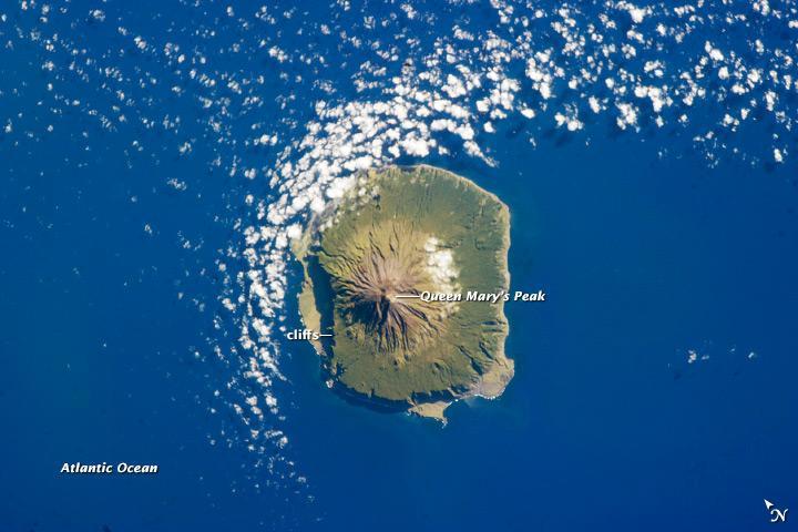
Island of Tristan da Cunha #

The island is notable for its bird population and includes important breeding grounds for petrels, albatrosses, penguins, and shearwaters. Tristan da Cunha is a shield volcano, a volcanic structure with a low, broad profile and composed of silica-poor lavas (such as basalt).
The upper surface of this low base appears dark green in this astronaut photograph of 6 February 2013. Steeper brown to tan colored slopes mark the central cone of the volcano at the islands center. The summit crater, Queen Marys Peak, sits at an elevation of 2,060 m (6,760 ft) above sea level.
While geologic evidence indicates that eruptions have occurred from the central crater, lavas have also erupted from flank vents along the sides of the volcano and from smaller cinder cones. The last known eruption of Tristan da Cunha took place in 1961-1962 and forced the evacuation of the only settlement on the island, Edinburgh of the Seven Seas, on the northern coastline (obscured by clouds in this image).
The town is considered to be the most remote permanent settlement on Earth, with its nearest neighbor located 2,173 km (1,347 mi) to the northeast on the island of St. Helena.