Flooding in Germany, 2013#
by Stas Sedov and Dmitry Chistoprudov, members of the AirPano Team that is member of the global-geography Consortium.15 July 2013
with kind permission of AirPano
We offer a joint tour of the thirteen panoramas over the flooded areas in Germany in June 2013.
Flood caught our crew in the Czech Republic, and we quickly created a virtual tour about the difficult situation in the northern part of the Czech Republic. After that, it was decided to continue to follow the "big water" and to show the scale of the flooding in Germany.
And now we give the floor to our photographers — Dmitriy Chistoprudov and Stanislav Sedov.
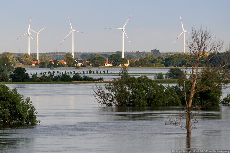
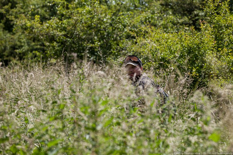
Having studied flood maps, forecasts, and online news reports for a long time, we decided to fly to Berlin. To be honest, we didn't hope to see the "big water", because it has already been a week and a half since the flooding started. I thought that while we were deciding when and where to fly, the water level would drop, but I was wrong. Our first designated search area was around Magdeburg, the capital of Saxony-Anhalt, on the Elbe River. The city was less than two hours drive from Berlin down the infamous German Autobahn. However, twenty kilometers to our destination point we got stuck in a traffic jam and didn't make it to Magdeburg. We have to hand it to the Germans, to their patience and discipline — the safety lane on the side of the road remained clear all the time. Even motorcyclists stood in traffic along with everyone else, which was rather shocking for us, people from Russia. Every now and then special services and military vehicles drove down the safety lane.
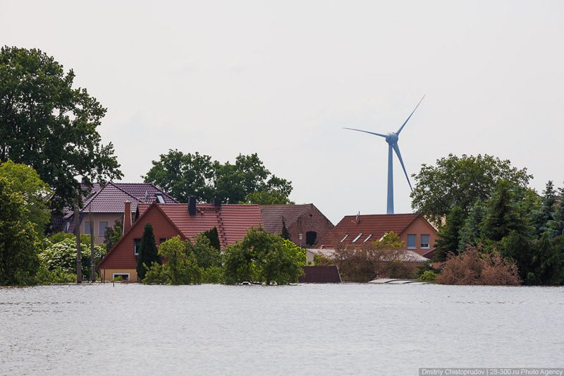
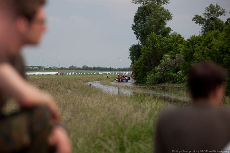
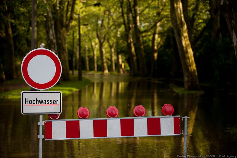
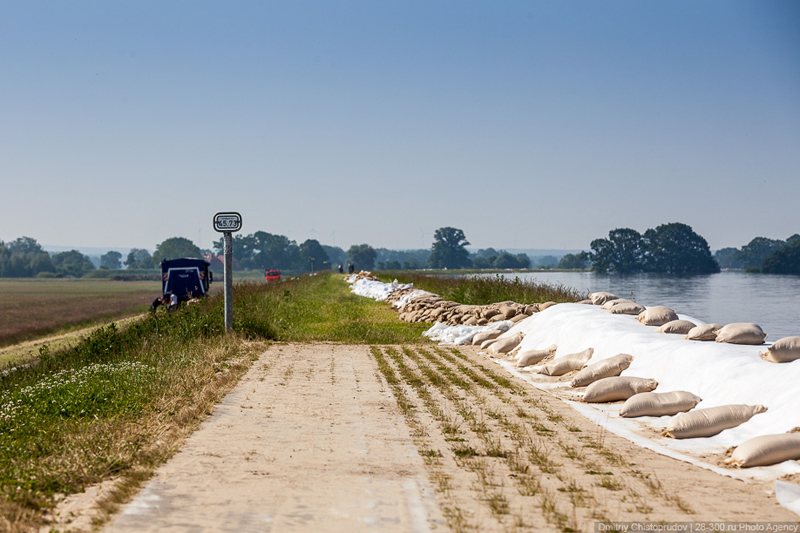
We took the first available exit, because we didn't want to waste any more time. Ten minutes later we saw the "big water". Niegripp village was suspiciously silent and deserted. Following our navigator to the general direction of Elbe River, we passed a couple of streets and ran into a "Road Closed" sign (we saw two hundred signs like that later during our trip). From our parking spot we saw a dam that was a couple of meters higher than our location — extra layer of sand bags raised the flood barrier by one more meter. The surrounding streets leading to the dam were "taped" off.
Local volunteers from Public Order groups patrolled most critical areas of the village. They spoke no English. Using signs and gestures, we found out that the penalty for crossing the tape (a safety margin) was 1000 Euros. We also saw water: it reached the top layer of sandbags on the other side of the dam. Another 20 centimeters and it would be a disaster. If it weren't for the increased height of the dam, Niegripp would be in water up to the roofs.
© AirPano
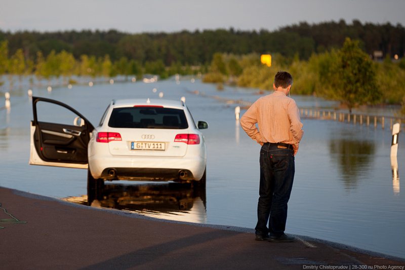
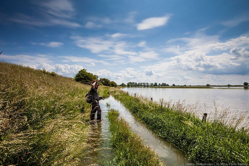
The water current was fast. It was very unusual and strange to see bushes, trees, street signs, and lampposts floating in the water. And it was even more unusual to see flooded homes in the distance. Seven hundred meters separated us from the Elbe River channel! Level of the raised water, its volume, and its speed made a horrendous impression on us.
We drove to the crossing in Rogatz, but couldn't get close to the river. All roads were blocked. A long line of military vehicles drove through the cordon line carrying equipment.
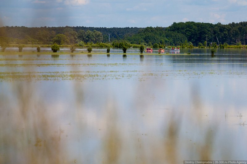
On the way back to Magdeburg we saw a lot of picturesque places: fields, meadows, forests, and small villages. It was there that I ignored the restrictive sign for the first time and kept driving. Otherwise we wouldn't be able to see anything. That's how we ended up in Lostau.
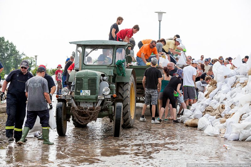
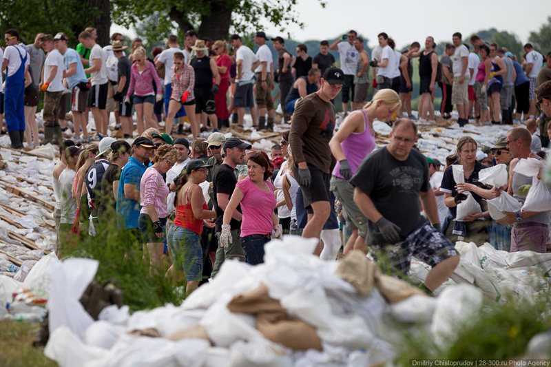
Most likely, it was a very calm and quiet village on any other given day. But the day we arrived it looked like a disturbed bee hive: at the entrance to Lostau we saw several hundred people filling bags with sand and loading them on trucks, tractors, passenger cars, and anything that could deliver a rescue material to the dam.
© AirPano
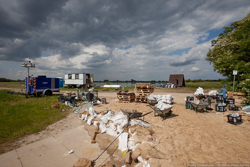
The most effective flood barrier is 15 kilograms of sand packed in a bag made ??of jute or plastic. These bags protect homes and venues from incoming water and strengthen the dam. After the flood in 2002 German Fire Department and Technical Assistance Agency had hundreds of thousands of these bags stored in case of another emergency.
© AirPano
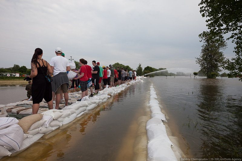
The water level in Lostau area rose 30 centimeters above the main dam and, if it weren't for the additional layer of bags and earth mound, the village would be completely flooded. The situation was critical.
© AirPano
Water kept rising slowly. It seeped through the dam and filled farm fields in front of houses. Thousands of volunteers continued their hard work. Firefighters pumped out water as fast as they could, and rescuers on flat-bottomed boats brought materials to fortify the dam in partially flooded areas.
© AirPano
This is where we shot our first panorama. The helicopter was still in the air when we saw a terrible picture on our screen: they couldn't save the old part of Lostau. We could see roofs of flooded houses and water stretching to the horizon.
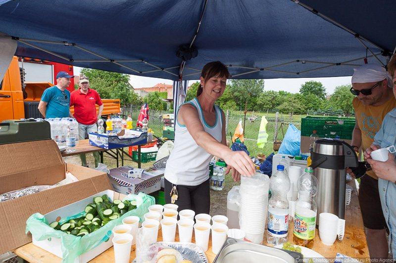
Despite the tragedy of the situation, people working on the dam were very cheerful, as if the Germans left their houses to celebrate yet another public holiday. There was laughter and jokes all around us. But the work was in full swing and didn't stop even for a minute. Maybe that was the reason that no one paid any attention to the flying helicopter. And those who did notice our presence tried to offer us food and water.
We were under impression that the flood united German people. The Germans helped each other selflessly in the face of this natural disaster: some of them volunteered to strengthen the dam, and some of them helped to transfer sand and filled the bags. Local residents made sandwiches, hot dogs, salads, tea, and coffee for the workers. Someone brought pallets with drinking water and juices (not even once did we see a place with volunteers that had no water supply).
© AirPano
Some people even took boats to flooded areas to milk cows that were left behind during the evacuation. During such difficult times townspeople, who usually fought over parking spots or argued about the fence color, showed deep solidarity.
Our entire trip was somehow pieced together by itself. As if someone decided everything for us. With the exception of a traffic fine we had to pay for ignoring yet another "Road Closed" sign. It happened in Rogatz. At first we saw some locals staring at us with suspicion: it seemed like they couldn't understand how a car with Berlin numbers ended up on a flooded road. And then we ran into a police vehicle.
Two angry looking policemen stepped out to greet us. I decided to speak only Russian: to make us look like stupid tourists got lost on the road and ended up where they shouldn't be. Stas showed them a navigation app on his phone, trying to prove that we were going in the right direction. Policemen listened to us and didn't understand a word we were saying. But it was clear that they wanted us to pay 1000 Euros fine, and their intentions were very serious. We came to an understanding. However, it turned to be not exactly so. Policemen drove back towards the road sign at a snail's speed. We followed them, not knowing what to do. We saw that one of them called someone on the phone and had a long conversation. We drove a few kilometers with a speed of 20 km / h passing flooded areas of the road, and finally reached the road sign. The police car stopped and the officer stepped out. During this little trip he managed to learn Russian language.
"No! Not that way! Sign! Penalty!" said policeman, pointing to a sign that we passed.
"Yes, but another car drove past it right in front of us and so we decided to do the same. Besides, our navigator leads us in this direction."
"You can't. Sign. Penalty!"
© AirPano
I opened a calculator app on my phone and gave it to the officer, who thought for a second, sighed, and wrote number 30. And so we were all square.
We took a detour around the problem area and arrived at Kehnert, where our navigator led us to. It was quiet in Kehnert. We found a local guy, who could speak English (which is very rare in those parts of Germany) and he suggested that we visit Weißewarte, where at that time, according to him, the flood situation was very critical. There was only one problem — that village was far away from the Elbe River. We decided to go there and see for ourselves.

© AirPano
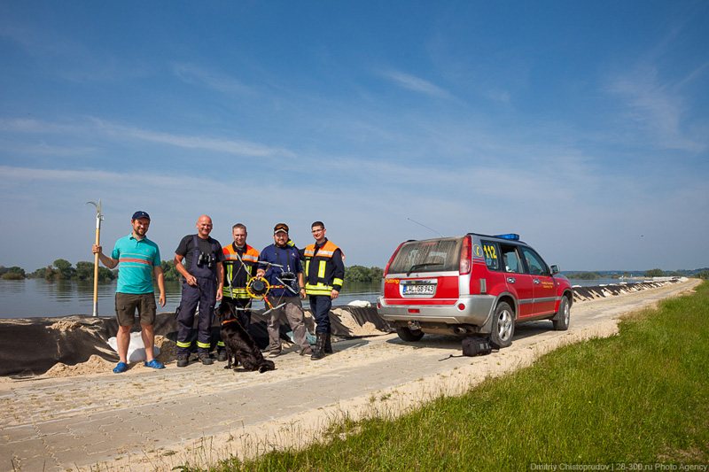
6 kilometers to Weißewarte the road was blocked. We had to walk one third of the way before catching a ride. Some fields around the village were completely flooded, as if it has been a rice plantation for several years. A fire truck drove past us, then it suddenly stopped, and backed up. Apparently, the chief of a local fire station was driving the truck and noticed a helicopter that Stas was carrying in his hands. When we successfully breached the language barrier with the help of our interpreter Mike, we found out that fire fighters need our help in assessing current flood situation. Panoramic photos would make their job a lot easier. For that they were willing to provide us with their vehicles and help us pass all police cordons.
And so things finally got moving for us! Locals knew all bypass roads and location of flooded areas. That day we traveled at least 250 kilometers. When Stas showed our footage to the fire station officers, they were so grateful that shook our hands for a long time. Considering the circumstances, we were glad to offer any help to the Germans.
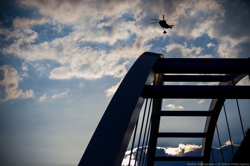
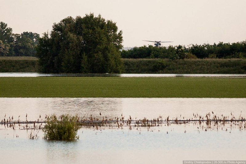
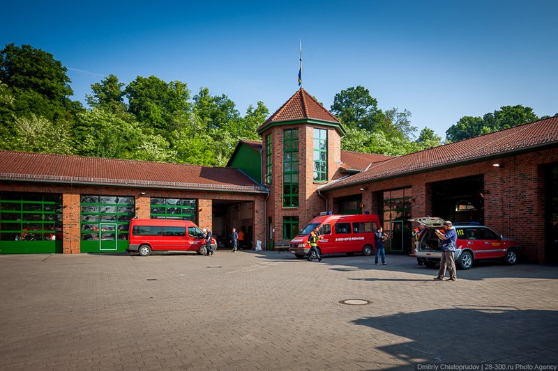
The same evening we went north down the river. Our fire fighter friends gave us a map with roadblocks. We arrived at Tangermunde two hours before the sunset. At the city entrance I noticed a passing fire truck and followed it to the fire station, which was exactly where we wanted to go. We went straight to the local chief to offer him our help. Impressed with our footage, he went to get approval from his boss. But that time it didn't work: Bundeswehr prohibited all flights in the area. There was a dam breach a few kilometers away from the city, in the Fischbeck area. And the only way rescuers and the military could reach the flooded area was by helicopter. That's why the air above the town was buzzing with big cargo helicopters transporting pallets with sandbags to the flooded area. We counted five helicopters that were flying in circles, dumping sand, and returning for a refill. At times altitude of their flight didn't exceed 300 meters.
© AirPano
We decided to get closer to where the dam was breached, and so we walked three kilometers straight. The road went through a closed bridge across the Elbe River, down to the fields, and then disappeared under the water. We could see submerged Fischbeck in the distance, but it was impossible to get any closer.
© AirPano
Somewhere behind the trees helicopters were dropping sandbags.
© AirPano
© AirPano
In the end, we managed to take a spectacular picture at sunset: waters of the Elbe River burst through the dam quickly flooding all riverside fields and roads. We carefully studied the footage in the hotel and found a trail that went across dry areas of the dam and led directly to Fischbeck homes.
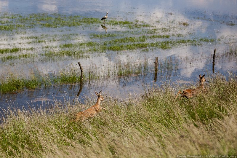
In the morning, armed with our intelligence data, we made our way across the dam and went towards the flooded areas. At first we went down the bike track, and then got stuck in terrible bushes, thorns, and nettles that reached high above our heads. It took us two hours to get to the village, which was 3 kilometers away. We crossed heavy streams of water that was knee high, and forced our way through dense thickets. Occasional swans and herons cast a suspicious glance at two strange men carrying a helicopter in their hands and cameras around their necks. Every now and then we saw roe deer rushing through the bushes. As for us, we were hiding from the helicopters in the sky. Journalists, whom we met on the bridge across the Elbe River, told us that we could end up paying 800 Euros fine for going to the dam.

© AirPano
© AirPano
We weren't looking for an easy way out. By the time we reached the village our arms and legs were scratched and burned by nettles. And I was the luckiest one, because I was wearing slippers and shorts.
© AirPano
© AirPano
From time to time we saw rescuers taking their boats through the water field and disappearing between flooded houses. Hiding in the bushes, we managed to launch our helicopter a couple of times. We were about to head back when Stas noticed a breach in the dam on one of the pictures. And we decided to keep going.
© AirPano
An hour later we arrived at the former battlefield of man versus nature. And it was obvious that nature won the battle.

© AirPano
It was a fast retreat: pallets with water, juice, and food were scattered all over the place. We saw an abandoned diesel generator surrounded by hundreds of sandbags. Open house on wheels turned out to be the headquarters: there were tables with maps, some notebooks, and batteries for portable radio transmitters. Everything was abandoned. The water destroyed about 100 meters of the dam. Rapid stream was flowing in the direction of a flooded village. The water level was rising at the rate of about 3 centimeters per hour.
© AirPano
We decided to make it fast — took a few pictures of the breach and went back. By evening we reached Mecklengurg with no trouble, and violated a prohibitory road sign in Boizenburg. Having parked our car in front of the fire station, we went to look for administration. Fire station chief didn't speak English, but they quickly found Hagen, the fire fighter, who helped us translate our proposal: we were willing to help them by taking panoramic photos of flooded areas. Then we had this conversation:
"How much do you charge for your services?"
"We don't need money. We are here to help."
"No, it doesn't work that way! I'm pretty sure you're going to charge us later."
"No, we won't do that. We'll do it for free!
"Hmm. Strange Russians"
© AirPano
After we took pictures of two areas and showed photos to fire fighters, happy administration went to discuss everything with the military. Bundeswehr soldiers arrived in the evening to help fire fighters and our footage came in handy when they were deciding on locations and a number of people they would be sending out in the morning. When they used a projector to show our panoramic photos from the air, military guys were very surprised, and the fire station chief was very proud of himself. Our work made the search in problematic areas of the dam easier and helped coordinating rescue missions in the area.
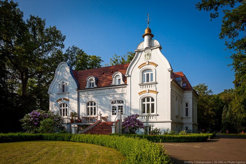
As a sign of appreciation, we were given accommodations in a luxurious mansion outside the city.
© AirPano
The following morning, after taking a few more pictures of the dam, we were taken to fellow fire fighters in a neighboring town of Lauenburg.
© AirPano
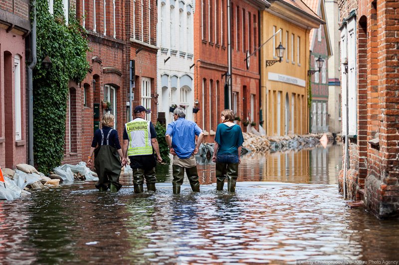
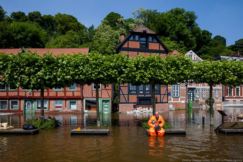
The historic center of Lauenburg was in a valley, and the dams couldn't protect it from the flood. Houses, some of which were more than 400 years old, were partially submerged under water. Fire fighters led us through the cordon and gave each of us a pair of waders. To get to the take-off site, we crossed the flooded street and went through the restaurant.

© AirPano
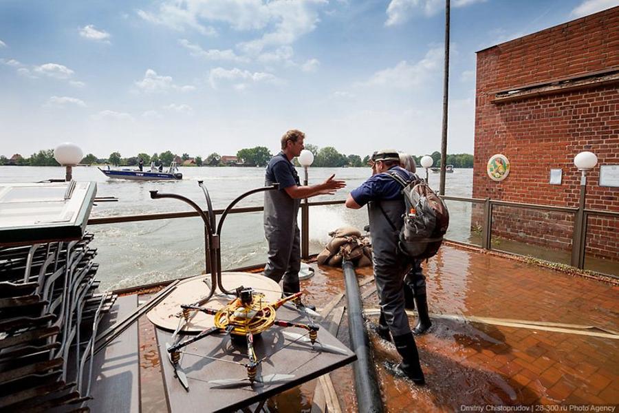
Inside there were small pieces of parquet floating like lonely little boats, and looking outside the window we saw murky waters the Elbe River almost at the level of a windowsill.

© AirPano
Standing in water, Stas launched the helicopter from a small front porch. Twiggs were swept by the rapid flow of the river right past us. But the most surprising thing was that the entire time we were there we didn't see any garbage in the water. There were no water bottles, packets, or other such trash. For that we bow deeply to the Germans.
Flood and natural disaster in Germany was a test not only for the local citizens and rescuers, but also for German politicians and officials. There were times when a lack of coordination between leaders of two neighboring states could lead to serious consequences.
© AirPano
For example, there was a difference in height of an additional fortification of the dam on the border between Mecklengurg and Lower Saxony. Mecklengurg fire fighters complained that their neighbors' dam was like a stab in the back: "Even if we had three-meter dam fortifications, all our efforts will go down the drain if the water breached through flimsy dam in Lower Saxony. Their state leaders don't think it's necessary to increase the height of the dam only to save their neighbors who live downstream. They have more important things to do. For the time being Mecklengurg is safe only because the Elba River overflowed much further upstream near Magdeburg, and flood is not so bad here."
© AirPano
We finished shooting floods in Lauenburg, gave our footage to fire fighters, and went to Berlin. By that time flood was approaching Hamburg, a city that knew firsthand what damage a flood can cause, and, therefore, it was well protected. They didn't need our help. I would like to express my gratitude to fire fighters, with whom we had an opportunity to work together, and all the people who helped us during our trip!
© AirPano
13 Panoramas of Flooding in Germany