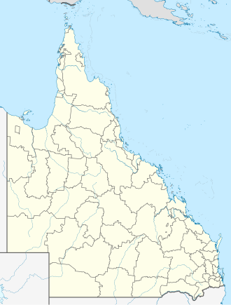
| Image Description | Credit | Artist | License Name | File |
|---|
| Positionskarte von Queensland , Australien | Eigenes Werk , using United States National Imagery and Mapping Agency data World Data Base II data Australian Government, Department of Infrastructure, Transport, Regional Development and Local Government | NordNordWest |
| Datei:Australia Queensland location map.svg |
| The Wikimedia Commons logo, SVG version. | Original created by Reidab ( PNG version ) SVG version was created by Grunt and cleaned up by 3247 . Re-creation with SVG geometry features by Pumbaa , using a proper partial circle and SVG geometry features. (Former versions used to be slightly warped.) | Reidab , Grunt , 3247 , Pumbaa |
| Datei:Commons-logo.svg |
| Flag of Australia, when congruence with this colour chart is required (i.e. when a "less bright" version is needed). See Flag of Australia.svg for main file information. | Eigenes Werk | Unknown (Vector graphics image by Ian Fieggen ) (only minor code changes by uploader.) |
| Datei:Flag of Australia (converted).svg |
| State flag and government ensign (internal waters only) of Queensland. FIAV 110010.svg : | Diese Fahne enthält Elemente von | Government of Queensland |
| Datei:Flag of Queensland.svg |
| Shiny red button/marker widget. Used to mark the location of something such as a tourist attraction. | Eigenes Werk | Andux |
| Datei:Red pog.svg |
| German immigrant family on their farm, probably in the Bethania area, Logan district, 1872 The early part of William Boag's career was spent in Sydney where he was in partnership with portrait photographer Joseph Charles Milligan. (Images made by Boag are in the collection of the Campbelltown and Airds Historical Society.).Boag arrived in Queensland in November 1871. He travelled around the south-east, along the foreshore of Moreton Bay and the township of Cleveland. He then moved into the Logan and Albert area where he captured images of local crushing mills and sugar plantations. While at Yatala, he took on a partner, John Henry Mills, and by the end of 1872, both men were in Stanthorpe where they remained for several months, producing views of the booming tin-mining settlement.In July 1873, after stopping off in Warwick, Boag and Mills extended their operations to Mackay, where they remained until October 1875. During this time, Boag made trips to St Lawrence and Cooktown, however his movements after this are difficult to trace. It is known that by mid 1876 he was at Copperfield and Clermont, and in February 1878, he inserted a notice in the Peak Downs Telegram announcing that he was leaving for the west. Then information ceases abruptly. It is possible that Boag never reached his destination, since his death certificate records that he died in 1878 at an unknown location.The first major German settlement occurred on the Logan River in 1864, when a group of 20 families of the Lutheran Free Church of Prussia established themselves on part of the extended Logan Agricultural Reserve (centering on what later became the town of Bethania). By 1867, two other associated settlements had been established further down the river - at 'Philadelphia' (Eagleby) and 'Elkana' (Alberton). All took up blocks of scrubland, establishing farms of between 30-80 acres and turning their attention to field crops such as maize, pumpkin, arrowroot and potatoes. Their northern European heritage was reflected in a unique type of architecture, of which a good example is this half-timbered 'barn'. Grain was stacked in the top storey, while the farmer's family probably lived below. Note the telescope displayed incongruously on a chair at far right in the photograph. Boag's patrons saw his visits as a means of documenting not just their own likenesses, but of affirming their place in the world by recording their most precious and personal possessions,. | Item is held by John Oxley Library, State Library of Queensland. | Boag, William, 1838?-1878 |
| Datei:StateLibQld 1 134905 German immigrant family on their farm, probably in the Bethania area, Logan district, 1872.jpg |


