Schönalmjoch
| Schönalmjoch | ||
|---|---|---|
 |
||
| Höhe | 1986 m ü. A. | |
| Lage | Tirol, Österreich | |
| Gebirge | Vorkarwendel, Karwendel | |
| Dominanz | 1,27 km → Fleischbank | |
| Schartenhöhe | 127 m ↓ Altjoch | |
| Koordinaten | 47° 29′ 10″ N, 11° 30′ 2″ O | |
|
|
||
| Normalweg | Hinterriß - Schönalmjoch | |
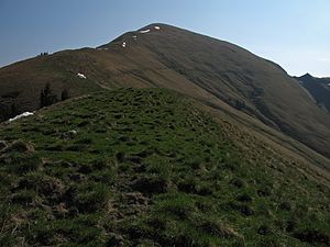
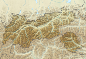
Das Schönalmjoch ist ein 1986 m ü. A. hoher Berg im Vorkarwendel, dem nordöstlichen Teil des Karwendels in Tirol.
Der Gipfel ist als einfache Bergwanderung von Hinterriss oder der Fuggerangeralm im Rißtal erreichbar.
License Information of Images on page#
| Image Description | Credit | Artist | License Name | File |
|---|---|---|---|---|
| Positionskarte von Tirol , Österreich | Eigenes Werk , using OpenStreetMap data SRTM30 v.2 data | NordNordWest | Datei:Austria Tyrol relief location map.svg | |
| a map symbol for a mountain, the center is in the middle of the base line - as opposed to Fire.svg | Eigenes Werk | Herzi Pinki | Datei:BlackMountain.svg | |
| Bewertungsicon "Quelle" für Artikel mit fehlenden Quellen. | based on Image:Qsicon_Quelle.png and Image:QS icon template.svg | Hk kng , Image:Qsicon_Quelle.png is by User:San Jose , Image:QS icon template.svg is by User:JesperZedlitz | Datei:Qsicon Quelle.svg | |
| Schönalmjoch | Eigenes Werk | Kogo | Datei:Schoenalmjoch.jpg |


