Wir freuen uns über jede Rückmeldung. Ihre Botschaft geht vollkommen anonym nur an das Administrator Team. Danke fürs Mitmachen, das zur Verbesserung des Systems oder der Inhalte beitragen kann. ACHTUNG: Wir können an Sie nur eine Antwort senden, wenn Sie ihre Mail Adresse mitschicken, die wir sonst nicht kennen!

unbekannter Gast

Victoria Falls, Satellite Image#
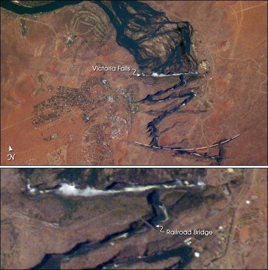
Victoria Falls, Satellite Image
Image courtesy of NASA., under PD
A closeup of Victoria Falls. The positions of the falls are controlled by linear fault lines in the underlying basalt rocks. The falls have moved upstream (bottom to top) by intense river erosion, elongating the zig-zag gorge in the process.

Prior positions of the strongly linear falls can be detected. The earliest on this cropped view may have been the longest (dashed line). The zig-zags represent subsequent positions, all with the characteristic water-worn lip on the upstream side. The falls will continue to erode northward.