New Maya towns found?#
By
All pictures were taken by the author and are protected by copyright.
Today Xpujil is a relatively fast growing Mexican city in the center of the Yucatan peninsula near the border between the states of Campeche and Quintana-Roo. In 1977, we, Annegrete Vogrin and I, camped near the ruins of Xpuhil next to one of the few gas stations along the mostly straight road knocked out of the forest between Escárzega and Chetumal. At that time there was no settlement at the ruins of Xpuhil. Only for the archaeologists a campamento was built here on the other side of the street. We wanted to see some of the scattered ruins of former Mayan cities near today's Xpujil. In addition to the gas station there was the small restaurant Oasis then, in front of which tank guests could buy preserved donuts, patatochips and biscuits in addition to Cervezas and alcoholic and non-alcoholic drinks. We were able to wash ourselves and our laundry in an Aquada, a pond that drew water from the rainy season and lay behind trees on the other side of the road at the archeology camp. This was uninhabited at the time and there were countless Mosquitos at the water.
Among other things, we wanted to visit the relatively near ruins of Channa, Chicanna and Becan, which we did. My most important destination in this region was then already La Muñeca, a large Mayan city from the Late Classical period around 800 AD, southwest of Xpuhil, in the middle of what was a huge forest area that reached far beyond the Guatemalan border at that time. La Muñeca had been studied, measured, photographed and published by Ruppert and Denison in the 1940s. Here you can find the remains of the then only known limestone vault in the Maya architecture (Architektur). Unfortunately, I did not find anyone in 1977 who could have taken me there.
When I returned to the Xpuhil ruins in 1985, there was already a small hotel where you could sleep more comfortably and a greater number of houses in the nearly identical settlement of Xpujil. To Juan de la Cruz Briseño, responsible for monitoring the ruins in the area, I suggested that we ride with two bicycles as much as possible and only walk the rest on foot. Unfortunately, Briseño was busy with several assignments and could not lead me to the ruins. Also, in 1987 it was not possible and at this time I was also not sure if there was even a way to La Muñeca. After that, I did not hear anything from this remote Mayan city for a long time.
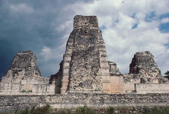
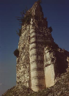
In 2003 I heard that two hunters had come across two large Mayan ruins next to each other on a hunting expedition with machetes in the forest south of Xpujil, to which they had already given two names - the western Mayan city "El Mirador", the eastern one "La Gran Parada" or "La Gran Parador".
After that, North American Jack Sulak, who was in Xpujil with a rented jeep at that time, engaged one of the two hunters to lead them to the newly discovered ruins. However, he probably left too late and also took clearly too little water for the long way with him. When he reached the ruins, he almost had no water left for the way back. His guide then did not find the more interesting stelae he wanted to show him, and so Sulak only saw huge, overgrown, steep hills that were obviously of artificial origin, a few completely smooth, partly there were already fallen stone steles and an altar.
Fortunately, he did a GPS measurement and then made his way back through the forest only with the massive support of the accompanying guide. Later, Jack confessed that he was already so dehydrated on the way back that for the first time in his life he was really worried about his life, afraid he would not be able to get out of the woods. It took him and his companion until the night. Jack needed several more weeks to recover from this extreme strain. Even as he was already back in the States, he still felt the consequences.
But his GPS measurement was very useful. Karl-Herbert Mayer immediately asked me to compare the GPS data with the coordinates of the location determination of Ruppert and Denison. Obviously, the two "newly discovered" Mayan cities were the two main groups of La Muñeca, now lost in the forest. So it was a long-forgotten Mayan city.
In 2004 I was in Xpujil again. In advance, Jack Sulak and I concluded that this time we will go to La Muñeca together - also to turn his negative experience into a positive one. This time, the journalist and Maya researcher Stephan Merk should also be there. I bought 21 half-liter bottles of portable water and provisions for the planned tour in a market in Xpujil the day before the planned march, prepared several breads with spread and packed everything ready for eating and drinking in my little backpack for the next day.
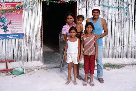
At 4:00 in the morning we met at the Hotel Mirador in Xpujil while it was still dark. Jack Sulak came with jeep and driver. In addition, Stephan Merk came with a second all-terrain vehicle. We all had plenty of provisions and water in our backpacks and drove east for about a mile to the intersection in Xpujil and then south to the settlement of Narcisco-Mendoza, where two more people from the Martinez family arrived and one of them knew the way to lead us. The other wanted to know the way and therefore came with us. Both were equipped with machetes and chainsaws.
From there we travelled about 20 km north back to a junction to the west. We drove on a partly very rocky, partly softened dirt track with deep ruts. After 6.8 km we reached a junction, from where we drove another 7.6 km, this time to the northwest, until the lane turned left at almost right angles. On the track several trees which had fallen had to be sawn and cleared out of the way. On the distinctive left-hand turning, there was just enough space to park the two vehicles between the trees next to the path.
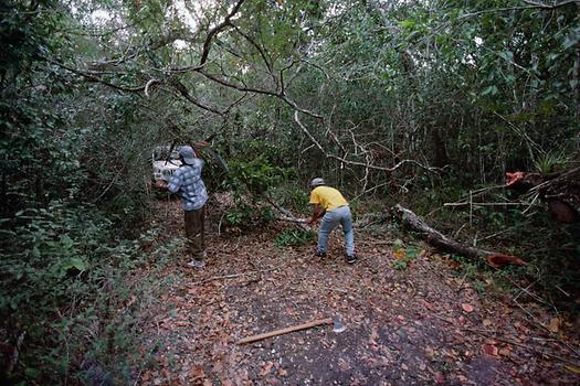
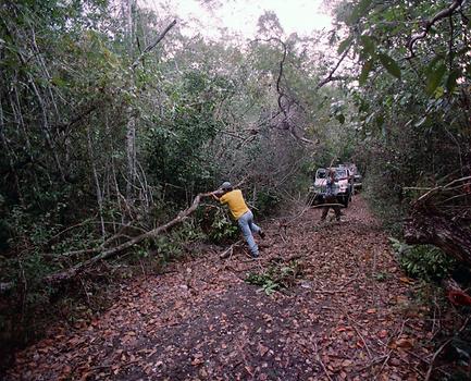
Until here the forest was relatively low and dense. From here, the trees were higher and soon reached the format of real rainforest trees. After seven minutes of walking we crossed a dry streambed. For long stretches the trail was barely visible. Lianas and slender saplings were already cut off on earlier hunts on the hunting trail downwards from the top with the machete, so that each had a sharp ending pointing upwards. You better did not stumble at any of those places. The many roots and further growing lianas on the ground seemed to invite you to fall down, where you can easily get stuck in a mess of roots and lianas.
Again and again, fallen trees had to be climbed over or under. In slightly more open areas, we recognized geometricized hills in the forest, suggesting settlement activity in pre-Columbian times. In one case, I even saw an open dummy vault of a Mayan building on the side.
After about one and a half hours, we took a break for 15 minutes, then quickly went on for just a bit less than an hour. On the whole way I drank one of the half-liter bottles of water after another and put back full bottles for the march back, so that I did not have to carry them along - assuming that on this day certainly no other person would go on this hardly walkable way.
Finally we reached the first high hills at 12:00 o'clock. The map of La Muñeca, already copied by me in Graz which the two Mayan researchers Karl Ruppert and John Denison Jr. had already published in 1943, did a great service. I immediately saw that we had arrived at Building I in the western part of the ruins, so I knew where we were on the map. There are huge, extremely steep hills throughout the center of the former Mayan city, but only two of these hills still bear recognizable remnants of upright architecture at the top of the substructure. These are the buildings XII and XVIII. Therefore, we were able to take a targeted way to my actual goal, to building XII. In building XIII we made a new GPS measurement (N 18 ° 13.167 '/ W 89 ° 36.703') Location='18.2630556, -89.79527777777777'.
Building XII, to which I had wanted to go for almost 30 years, soon stood in front of us. The substructure is extremely steep and high, especially when looked at from the northern side. But even on the flatter southern side you have to go up trees and lianas. Everyone came along and helped to record the construction on the top platform using tapeline measurements. The substructure consists of a small 5 m high platform standing again on a larger platform, whose height may be about 7 m. This stands on the extensive platform on which all the buildings of the central plaza stand. This again has about 4 m height in the area of building XII. At the northern rear of the building, a height of about 16 m is reached, which drops extremely steeply to the north. The building itself has three rooms whose central space opens to a small forecourt on the south side.
The first thing we noticed about the substructure was a tunnel system driven by raiders from the steep north side, making this base look like a perforated Emmentaler on several levels. In the base plate of building XII openings have been stemmed in two places, which are connected via vertical shafts with the tunnel system. From these floor openings you can fall down vertically to the natural terrain level if you are not careful enough on the platform in building XII. The measurement data was supplemented by photos, so that a detailed documentation of the structure should not be a problem in Graz.
Around the year 2000, two more true capstone barrel vaults dating from around the 1st century AD were found in Calakmul. Calakmul is only 30 km away from La Muñeca. However, the limestone vault in La Muñeca is much younger. It dates back to the 8th century AD. The findings in this region are raising the question of why the Maya developed and used the principle of the real vault relatively early, but did not use it more often. In general, they used porch vaults and similar constructions. Another question is whether or not there are any more capstone vaults in the region, and if some of them are from the Intermediate Period. After all, there are about 700 years between the capstone vault in Calakmul and La Muñeca.
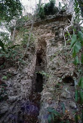
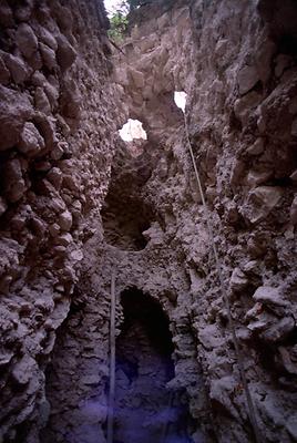
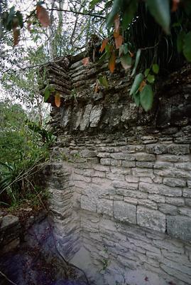
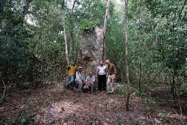
Afterwards we went for a walk through the ruins together and visited some of the stelae and altars among other things, in particular the three not yet stolen stelae 1, 5 and 13 with their inscriptions and reliefs. After some group photos we hurried to start the return journey to have enough time just in case.
So we went back strengthened and with less weight in the backpacks at 13:30. Jack Sulak was also no longer being in the condition of a young lad. In relation to his age of already over 70 years, he was still doing quite well on the way and with sufficient time and water, he could still take part in such a tour. We came back relatively quickly. Usually I led, so I was the first to find my bottles of water that I left behind which I immediately emptied drinking. At the end of the march I had drunk exactly 10 liters of water - one bottle remained filled. But my kidneys had hardly anything to process. I sweated out almost everything, so that the clothes were completely wet from the collar to the socks. In the humid heat in the forest, however, this resulted in a very desirable cooling due to the heat loss by evaporation. There were no fallen trees in the way on the way back. We first took the two companions to their home in Narcisco-Mendoza. Then we went to Xpujil, where we arrived at about 18:30. There was still a big dinner with good wishes and promises, as we wanted to continue travelling in different directions the next day.