Cities of Pakistan#
Author: Haris Naeem, August 2017
Introduction#
Pakistan with a population of close to 200 million and growing urbanisation has of course a large number of cities in its 5 provinces Punjab, Sindh, Khyber Pakhtunkhwa, Balochistan and Gilgit Baltistan.
A list of the largest cities by population, ranked with the larger ones first, is shown below. A discussion on how this ranking is achieved is presented as last section of this contribution.
| RANK | CITY | PROVINCE | POPULATION |
|---|---|---|---|
| 1. | Karachi | Sindh | 14,910,400 |
| 2. | Lahore | Punjab | 11,126,300 |
| 3. | Faisalabad | Punjab | 3,203,900 |
| 4. | Rawalpindi | Punjab | 2,098,600 |
| 5. | Gujranwala | Punjab | 2,027,000 |
| 6. | Peshawar | Khyber-Pakhtunkhwa | 1,970,000 |
| 7. | Multan | Punjab | 1,871,900 |
| 8. | Hyderabad | Sindh | 1,732,700 |
| 9. | Islamabad | Capital Territory | 1,014,800 |
| 10. | Quetta | Balochistan | 1,001,800 |
Following is a short description of the listed cities and few others which are noted for some interesting aspects.
1. Karachi Karachi #
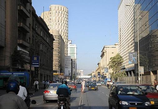
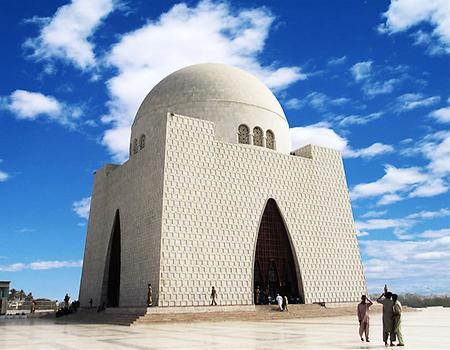
Karachi is the capital city of Sindh province and the largest city in Pakistan according to area and population. It is the 4th most populous city in the world. It is a coastal city located on the banks of the Arabian Sea. Therefore its climate is affected by sea, with high winds blowing most of the time. The city is considered to be the financial capital of the country because trade activity is highest in the area and most companies have their headquarters situated here. The city has a formal economy estimated to be worth $113 billion/year as of 2014. Karachi collects over a third of Pakistan's tax revenue and generates approximately 20% of Pakistan's GDP. It was the capital after independence till 1968, when Islamabad became capital.
Famous attractions in the city include Mazare Quaid (Founder of Pakistan, Quaid e Azam's mausoleum) Quaid e Azam, Clifton beach, various shopping malls, Pakistan National Museum, Pakistan Air Force Museum, Bagh Ibn e Qasim, Bagh e Jinnah(Jinnah Garden), Boat basin park and much more. Most of the film and drama industry of Pakistan is located in Karachi therefore both national and international events take place here all the time. Though, in recent years the city has faced many issues like rise in street crimes and municipality issues by the Government. The situation is improving from the past few months as Police as well as Rangers have taken care of security and several organizations are working with the Government to solve the problems of the huge number of residents living in the city.
2. Lahore Lahore #
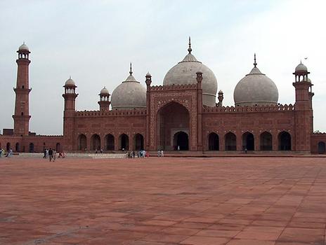
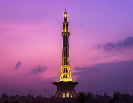
Lahore is the capital city of Punjab province and the second largest city in Pakistan. Lahore lies on the banks of the river Ravi at an altitude of about 215 m above sea level, a few kilometers from the border with India. It is a historical city and is considered to be the cultural hub of Pakistan. Lahore has beautiful mosques, mausoleums, parks and various shopping spots. Some of the places of interest include Badshahi Mosque, Shalimar Gardens, Minar e Pakistan (commemorating Pakistan Resolution 23 March 1940) Pakistan Resolution, Allama Iqbal tomb, Wagah Border(Pak-India Border), Anarkali Bazaar(Market) and Food Street. One can witness true Mughal architecture in the city by vising different areas.
Lahore is well known for its culinary delights. People living here are extremely fond of food and that is the reason it has the highest number of places for food with the tastiest dishes of any city. In recent years, Lahore has been upgraded quite a bit in its infrastructure where special attention has been given to the road network, greenery and cleanliness in the city. A Metro Bus was introduced in 2013 with a 27 km long track which connects major areas of the city. Another Orange Line Train project in under construction. it will connect the city by an elevated train line. No matter what, the highlight of this city are its food and its openhearted people. A saying goes in Pakistan, "One who has not seen Lahore is like he was never born".
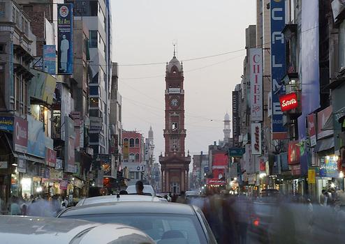
3. Faisalabad Faisalabad #
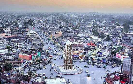
Faisalabad is a city in eastern Punjab. It is the industrial hub of Pakistan with the highest number of industrial units located here. As the area is surrounded by the Chenab river, various agricultural products are produced here including cotton, wheat, sugarcane, different fruits and vegetables. Faisalabad originally began as Lyallpur district in 1904 when it was named in honour of the then Lieutenant-Governor of Punjab, Sir James Broadwood Lyall, for his services in the colonisation of the lower Chenab Valley. It was later changed to Faisalabad in 1970s by the Government of Pakistan in honour of King Faisal of Saudi Arabia who has made many financial contributions to the area.
Faisalabad contributes 20 percent to the GDP of Pakistan and is often referred to as the "Manchester" of Pakistan. The Faisalabad Clock Tower(Ghanta Ghar) is a landmark of the city and its eight adjoining bazaars are each famous for their special items sold. Due to its high population and trade activity, Faisalabad is a very busy town. Roads and city areas are always crowded with people. Several cultural festivals are held in the city including Basant which is a very famous kite festival celebrated all over Punjab. Tourist attractions include Ghanta Ghar, various bazaars(markets), Jinnah garden, Company Bagh (where a monument on Sir Charles James Lyall is situated), Gatwala Wildlife park and Canal park. Theater is very popular throughout the city and many of the major shows are operated here.
4. Rawalpindi Rawalpindi #
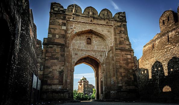
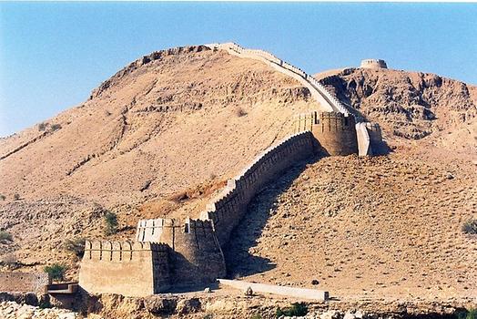
Rawalpindi is a city located in the Potohar region of Punjab. It is called the twin city of Islamabad as they are located side by side. It has an area of 259 square km and a population of about 320.000. The city was destroyed during the invasion of Mahmud of Ghaznavi before being taken over by Gakhars who went on to name the city as "Rawalpind" in 1493. In 1765, it became part of the Sikh empire and eventually came under British Raj in 1849. In 1851, it became the largest Garrison town of the British Indian Army and it is part of this reason that today the headquarters of the Pakistan army are situated here. Thus, it is a major military city. The area is socio-economically tied with Islamabad therefore it has a mixture of developed and still developing infrastructure. Punjabi culture reigns in the city as most of the residents are Punjabi speaking.People of Rawalpindi, especially youngsters who are called 'Pindi boys' are famous for their fun loving habits and activities. Places of interest in the city include Ayub Park, Jinnah Park, Bahria Town, Rawalpindi golf club, Liaqat bagh, Rohtas Fort, Paharwala Fort, Taxila heritage site(35km from Rawalpindi) and others. Liaqat bagh holds a critical spot in the history of Pakistan as two of the Prime Ministers of Pakistan were assassinated here: Liaqat Ali Khan in 1950 and Benazir Bhutto in 2007.
5. Gujranwala Gujranwala #
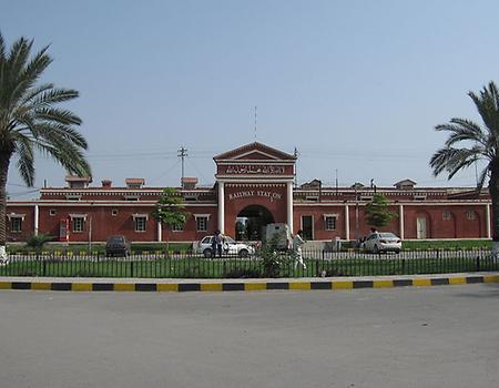
Gujranwala is a city located in Punjab.The city was under the rule of Ghaznavid dynasty till 1193. It was then ruled by the Sikh Empire after the decline of the Mughal dynasty. The British captured the area in 1848 and built a network of railway lines to connect Gujranwala with other cities of the Punjab. It has a hot, semi arid climate with winters remaining warm as well. The buildings in the area are built in British style including the main railway station of the city. The city is famous for its local wrestlers and their diet. People living here generally have a huge diet, comprising of lassi(milk with yogurt), bread(roti) and various dishes of chicken. Some attractions in the area include Sheranwala Bagh, Nishan e Manzil, Quba Park and Model Town Park. Along with other cities of Punjab, it is an epicenter for Punjabi culture.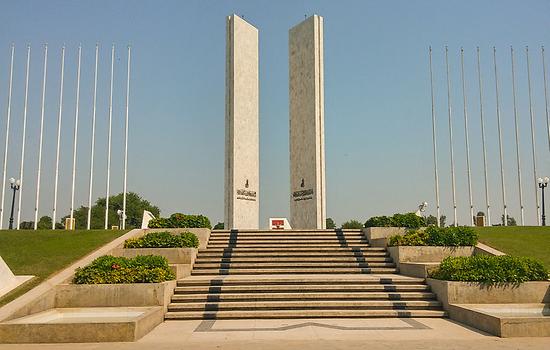
6. Peshawar Peshawar,Pakistan #
Peshawar is the capital city of Khyber Pakhtunkhwa province. It lies in the broad valley near the eastern end of Khyber Pass, close to the border with Afghanistan. Peshawar's history goest back to 539 BC, making it the oldest city in Pakistan. It has been a gateway to most of the explorers and invaders of the past starting from Alexander the Great to the Mauryans, Huns, Muslim explorers Abdullah Shah Durrani, Mahmud Ghaznavi and the Mughals. The Khyber pass which connects Afghanistan and Pakistan, is well known to be the route of most of these invasions. Today, it is a major trade route between Pakistan and other countries in Central Asia. Much of the old city of Peshawar consists of traditional architecture having high walls. Wood is used in many places for construction.
Tourist attractions in the city include the famous Qissa Khwani Bazaar, Bala Hisar Fort, Gurkhatri, Sikh Gurudwara, Wazir Bagh, Shahi Bagh, Peshawar Museum and others.
There are many cultural festivals held in the city specifically highlighting Pakhtun culture and traditions. Music is also important in the area. Local dances and instruments are famous around the world.
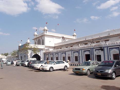
7. Multan Multan #
Multan is a city located in central Punjab along the banks of Chenab river. It is called the "City of Saints" because of its large number of tombs and shrines. The region of Multan has been continuously inhabited for the past 5000 years. Multan is believed to have been the Malli capital that was conquered by Alexander the Great in 326 BCE as part of the Mallian Campaign. After the Greek era, the city has been under the rule of various Muslim tribes like Ghasnavids, Tughlaqs, Suris, Mughals and then the Sikhs. The British took over the region in 1850 and built a series of canals in the area.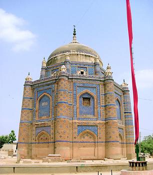
Photo: Junaid Ahmed, from Wikicommons, under CC BY-SA 3.0
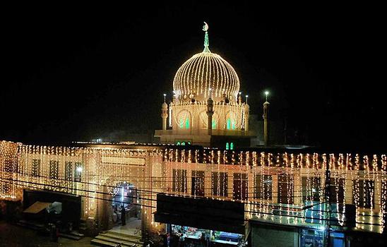
The climate of Multan is arid with very hot summers and mild winters. The city is famous for its production of mangoes of different variety. Due to the forts and shrines located in the city, Multan is considered a heritage site of Pakistan. Some of the famous shrines include the tomb of Shah Rukn e Alam, Bahauddin Zikriya, Shamsuddin Sabzweri, Khwaja Awais Kagha and Pir Adil Shah. They are all saints of Multan and each year, Urs (annual festivals) are held at tombs that are beautifully decorated for this purpose. People from other cities travel to Multan to attend the events.
8. Hyderabad Hyderabad,Pakistan #
Hyderabad is a city located in Sindh. It is the second largest city in Sindh, after Karachi. It is said that Mian Ghulam Shah Kalhoro of the Kalhora Dynasty founded the city in 1768. A formal layout of the city laid is due to his son, Sarfraz Khan, in 1782. It had been under the rule of Muhammad bin Qasim until the British arrived. The city lies on the east bank of Indus river which is the largest river in Pakistan. It has a hot climate with temperatures reaching 50 degree Centigrade in June. Winters are mild as well. Two of Pakistan's largest highways, the Indus Highway and the National Highway join at Hyderabad. Recently, Karachi and Hyderabad are also connected by a new Motorway. The area is a major agricultural producer of rice, cotton, wheat and fruits.Famous attractions in the city include Pacco Qillo (Fort built in Kalhoro dynasty), tombs of Talpur Mirs Talpur Mirs, Rani Bagh, Sindh Museum and others. The area of Sindh is famous for its Sufi poets and writers. Hyderabad has served many Sindhi literary campaigns throughout the history of Pakistan which is evident from its daily newspapers like Kawish, Ibrat and Daily Sindh.
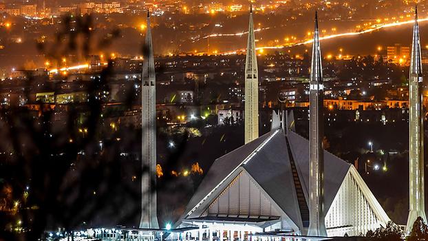
9. Islamabad Islamabad,Pakistan #
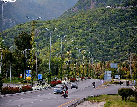
Islamabad is the capital city of Pakistan, located in the Potohar plateau below the Margalla Hills. It was built during the 1960s when the Greek architect Constantinos A.Doxiadis served as the lead architect of the project. The city's master plan divides it into 8 zones including administrative, diplomatic enclave, residential areas, educational sectors, industrial sectors, commercial areas, and rural and green areas. It is located in the federal district and does not form part of any province. Islamabad is the most well planned and modern city of Pakistan and has the best infrastructure in the country. Highlights of this city include Faisal Mosque, Daman e Koh (Hill station in Margalla Hills), Saudi Pak Tower, Pakistan Monument (Pakistan Monument), Pir Sohawa( Hill station few kilometers ahead of Daman e Koh), Centaurus shopping mall and the diplomatic enclave. The city is also known for its parks and forests including Fatima Jinnah Park and Margalla Hills National Park. It is monitored by 2000 surveillance cameras under the Safe city Project which makes it a very secure and peaceful city.
People residing in Islamabad are mostly natives of other cities having there jobs in the capital. Therefore it is a very diverse community. The city lies along the green belt so lots of plantation is to be seen as one travels along. The Metro Bus connects 26 of the major areas between Islamabad and Rawalpindi along with other public transport. Being the capital, air travel is also very high. Therefore a new International Airport is being constructed in Fateh Jang area, near the city, offering improved infrastructure and services.
10. Quetta Quetta,Pakistan #
Quetta is the capital city of Balochistan province. The city is known as fruit garden of Pakistan as numerous fruits are produced here due to its location and climate. It lies at an altitude of 1680 m therefore it has a generally cold climate with snowfall in winter making the temperature drop to less than -10 degree Centigrade. However in summers, the weather remains mostly dry and warm. Historically, the area has been under the rule of Mahmud Ghaznavi and Mughal emperor Humayun. It was briefly captured by British during the First Afghan War in 1839. It officially became part of the British Empire in 1876. People living here value to their traditions and culture highly. They wear traditional dresses like Shalwar kameez with a turban at top. For women, the dress is a long shalwar kameez with embroidery. Traditional Pushto and Balochi music is common here with instruments like rubab, sitar and flute. The famous dance of Pahtuns, Attan and Kathak originates from here and is known all over the world.Famous attractions in the area include Hanna Lake, Hazarganji Chiltan National Park, Command and Staff college museum, Archaeological museum, fruit parks and a few others. The bazaars(markets) in Quetta are famous for their handicrafts including Afghan rugs, fur coats, embroidered jackets, waistcoats, sandals, and other items. The traditional dishes are Kadi kebab, Lamb Roast and Saji. Overall, if anyone wants to witness the culture of Pakistan in one place Quetta is the city to visit !
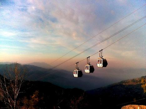
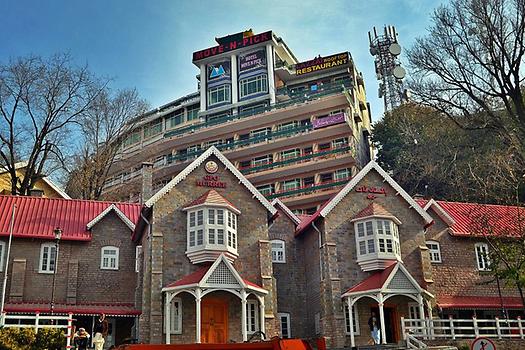
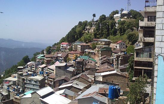
Murree Murree,Pakistan #
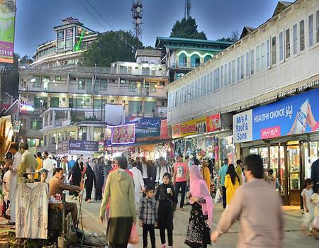
Murree is a town located in Punjab, about 50 km north of Islamabad. It lies at a height of 2291 m. Due to its locations in the hills and highland climate, it is perhaps the most visited tourist spot in the country. The mountains of the region are covered by oak and pine, covered with snow in winter season. Murree has old style buildings which are remnants of the British era. Many of them are still preserved the way they were originally built. The Pakistan Army and Pakistan Air Force have their cantonments situated in the region where there is also a school and training academy for cadets. The adjoining areas of Ayubia, Patriata, Bhurban, Nathia Gali and Changla Gali offer similar environment and attractions to the people and are frequently visited as well. In Murree, Mall Road is the main center for shopping and restaurants and if one walks further along the road, the chair lifts of Pindi Point can be used. They offer a spectacular view of the surroundings.
Cool summers and snowy winters attract people from other cities towards Murree. In fact, the city becomes so crowded on occasions like Eid and other national holidays that people are stuck on road towards the city for two to three days on average. So one must plan carefully before going here!
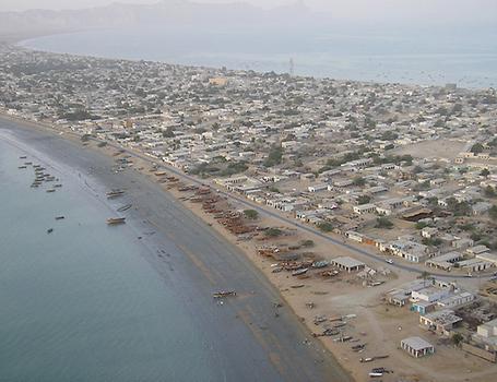
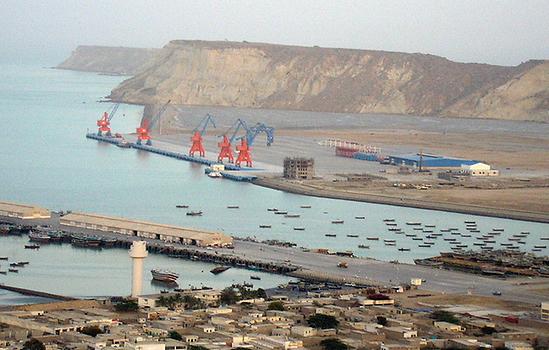
Gwadar Gwadar,Pakistan #
Gwadar is a port city on the southwestern coast of Balochistan. It is located on the shores of Arabian Sea. Gwadar and its surrounding regions were under possession of Oman from 1783 until Pakistan purchased the land in 1958 and integrated it into Balochistan in 1970. It is the largest deep sea port and has a lot of potential to serve as an economic corridor for South Asia. In April 2015, Pakistan and China agreed upon the $ 46 billion China Pakistan Economic corridor(CPEC) in which Gwadar will have a major role to play. The area is developed with an international airport under construction, several ports being made, hotels constructed as well as a network of roads that can link Pakistan with China through Gwadar. China has a key interest in the area because it will then have a shorter route for its oil supplies that come from the Persian Gulf. Gwadar has a hot, desert climate with high variations between summer and winter. Its culture is influenced by the Arab due to Omani rule in the region.Previously much of the economy was dependent upon artisanal fishing however now it is experiencing a rapid transformation under CPEC due to which tourism has increased in the region. It is considered that Gwadar will prove to be a game changer for the nation in the coming years.
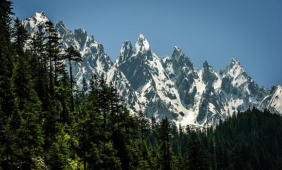
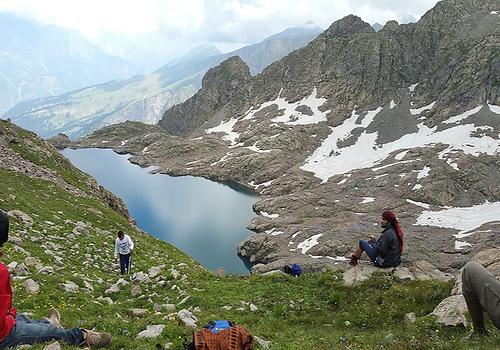
Swat District Swat,Pakistan #
Swat is a river valley in Kyber Pakhtunkhwa province. There are few cities in the valley like Saidu Sharif (capital of Swat) and Mingora. The area is nicknamed "Switzerland of the East" due to its natural beauty. The area has been inhabited for over 2000 years starting from the Greek and going on to Buddhists, Hindus and eventually the arrival of Islam by Ghaznavids and then Yousafzais. There are a number of Buddhist relics found in the valley and Buddhist tradition holds that Buddha himself came to Swat during his incarnation as Gautama Buddha and preached to the people here.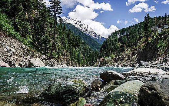
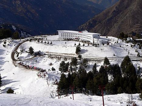
Swat lies in the lap of mountainous ranges of Hindu Kush providing unparalleled scenery. The plains in the area start from the city of Malakand, consisting of valleys, rivers and lush green meadows . The economy of Swat depends 38 percent on tourism and 31 percent on agriculture. There are a number of tourist attractions in the area which include Fizagat park, Malam Jabba (largest ski resort in Pakistan), Swat Museum, Miandam, Kalam, Utror, Pari(Fairy) Lake, Kundol Lake, Bashigram Lake. Various other locations also offer breathtaking views of nature and provide good recreational facilities. Lakes of the valley have a good variety of fish and minerals. Handicrafts of Swat are very famous including stone art, woolen shawls, rugs, embroidery and furniture. The noble prize winner, Malala Yousafzai is from Swat along with other notable personalities of the country. All in all, if one wants to see the natural beauty of Pakistan, Swat is the place to visit.
Sialkot Sialkot #
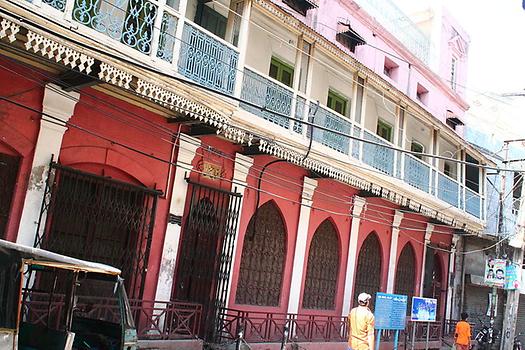
Sialkot is a city in eastern part of Punjab. Sialkot is believed to be site of ancient Sagala, a city razed by Alexander the Great in 326 BCE, and then made capital of the Indo-Greek kingdom by Menander. It has then been under the rule of Mughals and eventualy the British in 1849. Sialkot has been noted for its entrepreneurial spirit, and productive business climate. The relatively small city exported approximately $2 billion worth of goods in 2015, or about 10% of Pakistan's total exports. Sialkot is also home to the Pakistan's first privately owned public airport. It is the only full export oriented city of the country where 99 percent of the items manufactured are exported to the world. Some of the major exports are sporting equipments including footballs for FIFA world Cups and surgical instruments. Sialkot is the world's largest producer of hand-sewn footballs, with local factories manufacturing 40-60 million footballs a year, amounting to roughly 70% of world production.Allama Iqbal, famous poet and pioneer of the Pakistan movement was from Sialkot. Some of the tourist attractions include Iqbal Manzil(residence of Allama Iqbal), Sialkot Clock Tower, Gulshan e Iqbal park and Sialkot Fort. The city is a proof of the skills and workmanship of Pakistani people.
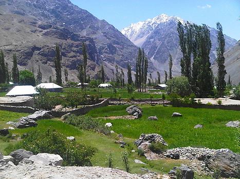
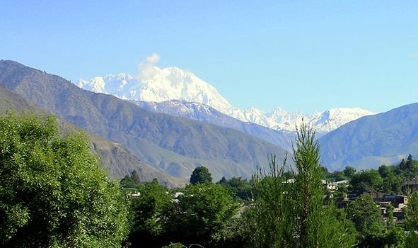
Chitral Chitral #
Chitral is a city in Khyber Pakhtunkhwa province. It is the capital of Chiral District and lies at the foot of Tirich Mir, which is the highest peak of Hindu Kush at 7708 m. The city lies at an altitude of 1100m. It was incorporated in Pakistan in 1969 after its status as a princely state under British rule. Chitral is one of the two major hubs for mountaineering expeditions into the Hindu Kush. Mostly Pashtuns reside in the area but the main language spoken is Khowar which is an Indo-Aryan language. People living here are generally unlike other Pakistanis in appearance. Most of their ancestors have come here from places like China and Tajikistan.Famous attractions in the city are Tirich Mir Tirich Mir, Chitral Museum, Shahi Masjid, Shahi Qila(Fort), Shandur Polo ground, Shandur lake, Kalash and Ayun Valley. It is a favourite holiday destination of many people, especially in summers.
Comments on the ranking#
The ranking of the ten largest cities as given at the beginning is based on Pakistan Population Census 2017 2017 Census
Such ranking is not easy, since the size of the population of cities varies a lot from source to source. Reasons are different years from which the figure is quoted; different area (central city, main city, metropolitan area); figure based on official count or estimates, etc.
To show this issue let us consider the size of the population of the captial Islamabad in various sources:
- Wikipedia "Islamabad had an estimated population of around 1.67 million in 2011 which according to the estimate of Population Census Organization will rise to around 2 million in 2020"
- Wikipedia 529,180 by 1998 census
- Wikipedia "Islamabad had an estimated population of 2.0 million in 2014"
- Worlpopulation Review "Population in 2017 is 1,502,000"
- Dawn "Islamabad’s population touches two-million mark. August 07, 2012"
- Pakistan Bureau of Statistics "Population - 1998: 805235 persons"