Wir freuen uns über jede Rückmeldung. Ihre Botschaft geht vollkommen anonym nur an das Administrator Team. Danke fürs Mitmachen, das zur Verbesserung des Systems oder der Inhalte beitragen kann. ACHTUNG: Wir können an Sie nur eine Antwort senden, wenn Sie ihre Mail Adresse mitschicken, die wir sonst nicht kennen!

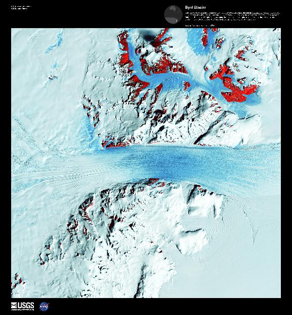
Byrd Glacier #

Byrd Glacier
Image courtesy of USGS., under PD
Truly a river of ice, Antarcticas relatively fast-moving Byrd Glacier courses through the Transantarctic Mountains at a rate of 0.8 km (0.5 mi) per year.

More than 180 km (112 mi) long, the glacier flows down from the polar plateau (left) to the Ross Ice Shelf (right) in this false-color satellite image. Long, sweeping flow lines are crossed in places by much shorter lines, which are deep cracks in the ice called crevasses.

The conspicuous red patches indicate areas of exposed rock. The glacier was named for Rear Admiral Byrd, US Navy, who was an Antarctic explorer.