Drei-Linden-Siedlung
| Drei-Linden-Siedlung (Siedlung) | ||
|---|---|---|
|
|
||
| Basisdaten | ||
| Pol. Bezirk, Bundesland | Hallein (HA), Salzburg | |
| Pol. Gemeinde | Puch bei Hallein | |
| Ortschaft | Urstein | |
| Koordinaten | 47° 43′ 32″ N, 13° 5′ 25″ O | |
| Gebäudestand | ca. 1600 | |
| Postleitzahl | 5412 Puch bei Hallein | |
| Vorwahl | +43/6245 (Hallein) | |
| Statistische Kennzeichnung | ||
| Zählsprengel/ -bezirk | Puch-Umgebung | |
| Quelle: STAT: Ortsverzeichnis; BEV: GEONAM; SAGIS | ||
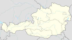
Die nördlich vom Hauptort Puch gelegene Drei-Linden-Siedlung (auch Drei-Linden-Raschl-Siedlung) ist eine Siedlung in der Gemeinde Puch bei Hallein im Tennengau im Salzburger Land. Nahe der Siedlung gelegen ist der Bahnhof Puch Urstein samt S-Bahn- und Regionalbus-Verbindung.
| Prähausen | ||
 |
St. Jakob am Thurn | |
| Puch (Gemeinde Puch bei Hallein) | Puch (Gemeinde Puch bei Hallein) |
License Information of Images on page#
| Image Description | Credit | Artist | License Name | File |
|---|---|---|---|---|
| Gemeinde Puch bei Hallein | Datei:AUT Puch bei Hallein COA.jpg | |||
| Positionskarte von Österreich | Eigenes Werk mittels: United States National Imagery and Mapping Agency data World Data Base II data File:Austria location map.svg von User:Lencer | NordNordWest | Datei:Austria adm location map.svg | |
| Compass card with German wind directions | Eigenes Werk | User:Madden | Datei:Compass card (de).svg | |
| Shiny red button/marker widget. Used to mark the location of something such as a tourist attraction. | Eigenes Werk | Andux | Datei:Red pog.svg |


