Kunashir Island. Southern Kurils, Russia#
Photos by Sergey Semenov,
member of the AirPano Team that is a member of the global-geography Consortium.
1 October 2021
with kind permission of AirPano
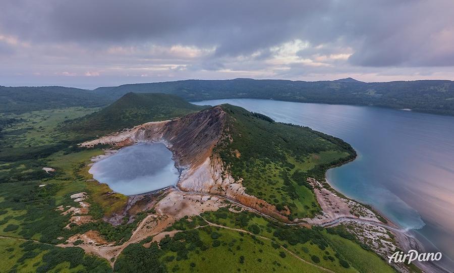
Our Far Eastern cycle continues with a story about Kunashir, the southernmost island in the Great Kuril Chain. In the Ainu language, this name means ‘black': this colour specification refers to dark coniferous forests and the gloomy appearance of volcanoes.
© AirPano
The legendary and fascinating Ainu people are the most ancient folks in the region who once inhabited the lower reaches of the Amur, the areas of Kamchatka, Sakhalin and the Kurils. The evidence of their presence on Kunashir Island dates to the Neolithic era: the ceramics being at least 5,000 years old were found here. The significance of the Ainu is reflected in their self-designation; this word means ‘a real person'. Although now they are small in number and live only in Japan.
© AirPano
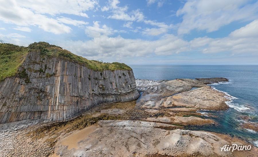
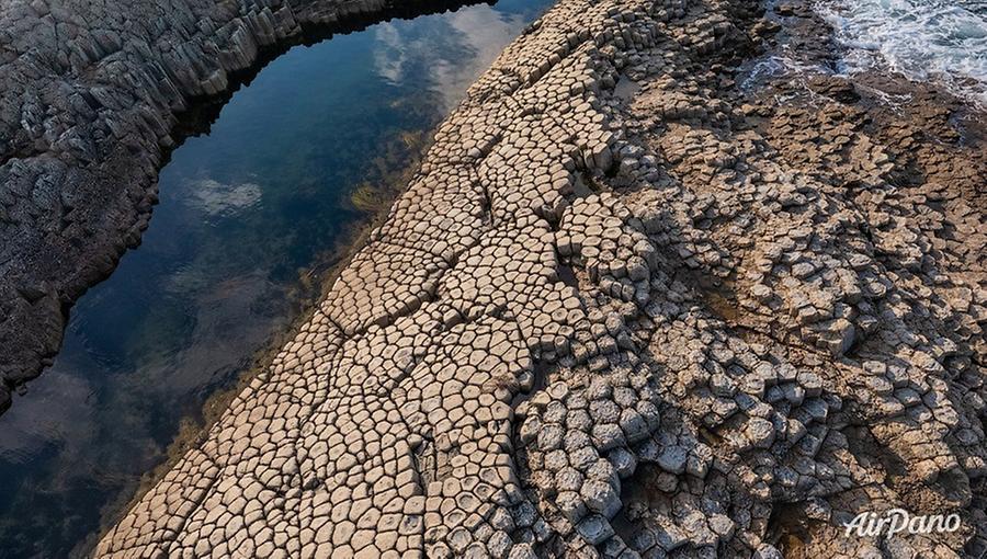
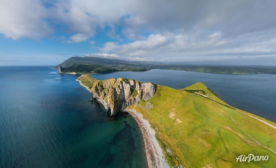
Kunashir is separated from Iturup Island (the one that was described in the previous AirPano tour) by the Catherine Strait. The island stretches northeast to southwest for 123 kilometres; the length of its coastline is more than 340 kilometres. The views here are even more fantastic and they are best admired from the water: the eye meets amazingly broken and piled rock formations with harsh waves falling on them. One of the most notable natural landmarks is Cape Stolbchaty (‘Cape Columnar') on the west coast. For centuries, Mendeleev volcano had worked on its creation: basalt lava overlapped in layers, solidifying in the form of columns with five or six faces. At the same time, erosion caused by the sea continues and these two elements have turned the cape into picturesque sheer cliffs that protrude into the Kunashir Strait.
© AirPano
This whole area is often compared to the Irish Giant’s Causeway, but this fact does not describe all the beauty and power of this area: the Kunashir landscape leaves an even stronger impression making you feel like you are on another planet.
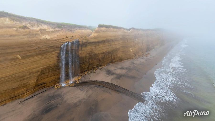
There are four active volcanoes on Kunashir. The highest is Tyatya, or ‘father-mountain': 1,819 meters. It is followed by Rurui (1,485 m), Mendeleev (886 m) and Golovnin (541 m). Thanks to their constant activity, fumaroles and thermal fields are spread around and geysers gush from the ground. You can swim in warm springs near volcanoes! And on the Pacific side of Kunashir, in the fiery caldera of Golovnin volcano, there is the Golovninsky cliff: an incredible wall with fifteen-meter waterfalls rolling straight into the ocean.
© AirPano
The fact is that despite the dense cloudiness, you can get a sunburn here. The island is located on the same latitude as the resorts of the Black Sea coast. Thanks to that, the most amazing plants are found here. It is difficult not to notice them because sometimes you have to wade through the bamboo bushes, a real jungle formed by the Kuril sasa! In autumn, the fields of red berries are scattered with bright flashes: berries which both in appearance and their healing properties resemble cranberries. And another unique local species is the Kuril apple: a relative of the rose hips with truly gigantic and juicy fruits.
© AirPano
If you ever happen to visit these lands, make sure to be assisted by local guides: they not only have all the necessary tourist equipment, boats and other transport, they will also show you where you can catch delicious Kuril fish and help you avoid meeting numerous local bears! In our case, the Adrenaline Tour company and the wonderful photographer Victoria Rogotneva provided invaluable assistance. This is how this completely safe AirPano tour was created. We hope you like it!
19 panoramas of Southern Kuril Islands- Kunashir