Undersea Volcano Eruption (2009)#

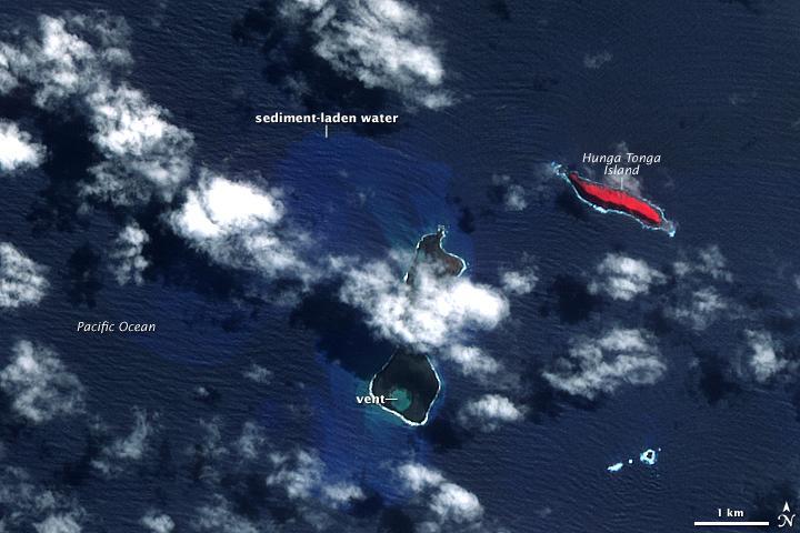
The eruption occurred at two vents, one submerged and the other on Hunga Haapai. The eruption pumped out enough rock and ash that by 25 March, when NASAs Terra satellite captured this image, the submerged vent was surrounded by new land. The new land is the dark mass south of Hunga Haapai.
It was not present in an earlier image taken on 14 November 2006 (next photo). In this image, clouds cover the space between the new land and Hunga Haapai, but the new land connects Hunga Haapai with the underwater vent, essentially enlarging the small island. The vent itself is the nearly perfectly circular hole near the southern edge of the new land. Also revealed are some of the other impacts of the eruption.
The ocean around the erupting volcano is bright blue, likely colored with ash, rock, and other volcanic debris. The eruption killed or damaged plants on Hunga Haapai. In this false-color image, plant cover is red. In 2006, Hunga Haapai had supported vegetation, but after the eruption, the island was black. Either the plants were buried in ash or dead in the wake of the eruption.