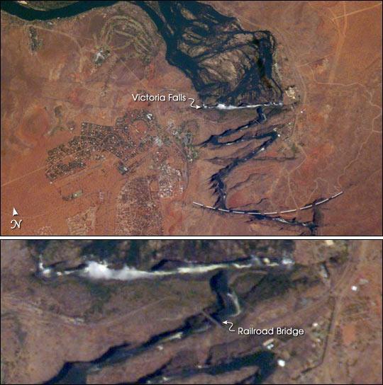
Victoria Falls, Satellite Image#

Image courtesy of NASA., under PD
The earliest on this cropped view may have been the longest (dashed line). The zig-zags represent subsequent positions, all with the characteristic water-worn lip on the upstream side. The falls will continue to erode northward.